“Grating the Nutmeg,” the podcast co-produced by State Historian Walt Woodward and “Connecticut Explored” magazine, continues to deliver the goods, proving itself as essential listening for anyone interested in Hartford history and Connecticut history in general.
 Hartford’s one-time prominence as a publishing center comes up in this episode, in which Woodward and co-host Brenda Miller of the Hartford History Center at the Hartford Public Library interview Keith Staveley and Kathleen Fitzgerald about their book, “United Tastes: The Making of the First American Cookbook.” The title refers to “American Cookery,” first published in Hartford in 1796 and commonly regarded as the first cookbook published in the United States. The identity of the author remains a mystery; the name on the title page–Amelia Simmons–turns up in no other records from the period. There’s no mystery, however, about the publisher. The partnership of George Goodwin and Barzillai Hudson were already publishing the Connecticut Courant (today’s Hartford Courant) and couldn’t keep up with the demand for another title of theirs, Noah Webster’s spelling and grammar book, widely known as the “Blue-Backed Speller.” As Woodward notes in the podcast, the cookbook appeared to fit into Hudson & Goodwin’s effort in those years, just after the Revolution, to promote “Americanism.”
***
Another episode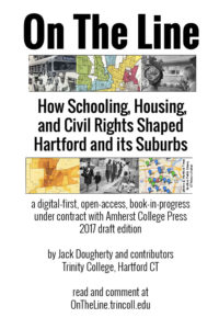 deals with the Hartford region’s history of housing discrimination through redlining, steering, exclusionary zoning, and property covenants. The guest is Trinity College’s Dr. Jack Dougherty, whose online book, “On The Line: How Schooling, Housing, and Civil Rights Shaped Hartford and Its Suburbs,” uses West Hartford as a case study.
Though titled “The Challenge of Fair Housing in Connecticut’s Suburbs,” the podcast episode deals in several respects with Hartford. For instance, when the federal government sought to revive the home mortgage market as an antidote to the Great Depression in the 1930s, it partnered with lenders to create maps that would highlight some neighborhoods as better-than-expected risks for mortgages. But the maps also showed the poorer risks–based not just on the prospects of repayment, but on such social criteria as the percentage of foreign-born or African-American families. As a result, these so-called poor-risk neighborhoods (color-coded as red on the maps, hence “redlining”) became still less attractive to lenders, which in turn made them poorer. Dougherty notes that in Hartford’s case, the neighborhoods red-lined in the ’30s tended to lie along the Connecticut River, then known as the East Side.
Then there’s the discriminatory obstacles that Jewish families in the city’s North End faced in trying to move to West Hartford and other suburbs following World War II — a story that would be all too familiar to other racial and ethnic groups that initially settled in Hartford.
***
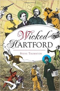 Still another Grating episode spotlights Steve Thornton’s new book, “Wicked Hartford.” Rather than the vice and tabloid scandal implied by the title, Thornton’s work focuses on the struggles of Hartford’s 99 percent. “I wanted to talk about the unsung heroines and the overrated heels,” Thornton tells CT Explored Assistant Publisher Mary Donohue in the podcast. “I wanted to talk about people who were enslaved and people who were entitled. I wanted to make that contrast, because history is usually written for and by the ‘great’ white men of our past.” Among Thornton’s heels is Hartford’s most revered industrialist, gun maker Samuel Colt, who is called out for selling weapons to the South as well as the North in the lead-up to the Civil War — something widely known at the time but largely ignored now. “It’s really amazing that we’re willing to overlook that,” Thornton says.
The book also brings to light, among other things, the city’s Seyms Street jail, which became so notorious for its deplorable conditions that it drew national attention; the plight of “newsies” and other child laborers; and the struggles city residents faced during the Great Depression.


 Hartford’s one-time prominence as a publishing center comes up in
 Still another Grating episode spotlights Steve Thornton’s new book, “